Fafa Team
Built at Meta Global AI Developer Hackathon · Oct 26, 2026 · Remote
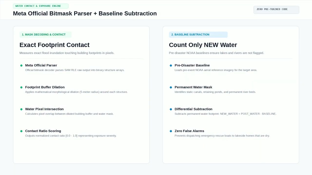
SIGAP-Banjir turns one drone photo of a flooded neighborhood into an evacuation-ready situation report — affected houses counted, priorities ranked, cut-off roads flagged — in under a minute. Problem. In Indonesia's rainy season, first responders (BPBD/SAR) receive raw drone/UAS photos of flooded areas long before they can reach them. Turning those photos into decisions — which houses are surrounded by water, which roads are impassable, where boats go first — is done by eye and takes hours per flight. Solution. SIGAP-Banjir is an agentic pipeline: (1) SAM 3.1 (Meta Model API) segments houses, water, and roads in an aerial photo; masks are decoded with Meta's official parser. (2) A measurement stage computes, per house, a water-contact fraction around its footprint, with permanent water baseline-subtracted using a pre-flood image, so only new inundation counts. Road segments overlapping new water are flagged for access checks. (3) A Muse Spark agent converts the measurements into a validated Indonesian situation report (sitrep) — totals, priority houses (contact ≥ 0.10; severe ≥ 0.20), flagged roads, recommended actions, and an explicit uncertainty note (pixel data says nothing about depth, occupants, or structural damage). The same JSON drives a situation-room dashboard. Runs by non-programmers. The whole chain is wrapped in one command — tools/olah_foto.py --before <photo> --after <photo> takes a raw before/after photo pair to measurements, overlay, and sitrep — with a step-by-step beginner tutorial in Indonesian (docs/TUTORIAL.md), including public-domain practice photos, so a responder with no coding background can operate it. Validation (scored, against ground truth). On a 20-image labeled FloodNet subset (UAS post-Harvey; object-based scoring, IoU ≥ 0.3), at the operational contact threshold 0.01: precision 77.5%, recall 14.8%, F1 0.249 (253 buildings evaluated; full definitions in docs/VALIDATION.md). We position SIGAP honestly as a Tier 1 high-confidence rapid triage tool: its flags are trustworthy for first-hour prioritization; it does not claim to find every flooded house. Live evidence. On a NOAA post-Harvey West Houston aerial, the end-to-end pipeline detected 92 houses, identified 9 priority houses touched by 39,437 pixels of genuinely new water, and flagged 2 road segments — producing the sitrep in seconds. Built during the event. The entire system (pipeline, sitrep module, dashboard, validation harness and report) was built during the hackathon week in the public repo above; the only pre-existing assets are the public NOAA imagery and the FloodNet dataset (CDLA permissive; Rahnemoonfar et al., IEEE Access 2021).