CivicLens AI
Built at Meta Global AI Developer Hackathon · Oct 26, 2026 · Remote
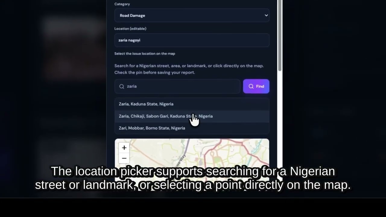
# CivicLens AI — AI-Powered Civic Infrastructure Intelligence **Live Website:** https://civiclens-ai-jbup.onrender.com/dashboard **GitHub Repository:** https://github.com/Abbagigo13/civiclens-ai **3-Minute Demo Video:** https://youtu.be/pV172cxkL74 ## What We Built CivicLens AI is an AI-powered civic infrastructure reporting and community intelligence platform that helps people document, understand and track problems affecting the places where they live. Across many communities, infrastructure problems such as damaged roads, potholes, poor drainage, flooding, waste accumulation and deteriorating public facilities often go unnoticed, remain undocumented or are difficult to communicate effectively. Citizens may see these problems every day, but turning observations into useful, organized and actionable reports is not always easy. CivicLens AI aims to bridge that gap by combining AI-powered image analysis, location-based reporting and a centralized community reporting dashboard. ## Who It Is For CivicLens AI is designed for: - **Citizens and residents:** People who want to report infrastructure problems in their neighbourhoods and communities. - **Community groups and advocates:** People working to improve public spaces and bring attention to local issues. - **Civic organizations and NGOs:** Organizations interested in documenting infrastructure conditions and understanding community needs. - **Local governments and public institutions:** Potential users who could use organized community reports to identify infrastructure problems and prioritize interventions. Our initial focus is on communities in Nigeria, with the vision of making civic reporting accessible to communities across Africa and beyond. ## What the Platform Does **1. AI-Powered Infrastructure Analysis** Users can upload an image of an infrastructure problem and receive an AI-generated preliminary assessment using Meta's Muse Spark through the Meta Model API. The analysis identifies visible observations, possible concerns, supporting visual evidence, confidence information and limitations. The goal is to help users turn an ordinary photograph into a more informative infrastructure report. **2. Location-Based Civic Reporting** Users can associate reports with geographic locations using the interactive map and location picker. This helps connect infrastructure problems to the communities and places where they occur. **3. Centralized Report Management** Reports are organized in a dashboard where users can view submissions, inspect report details, update report statuses and manage priority levels. **4. Community Infrastructure Overview** The dashboard presents report statistics, recent activity and community impact indicators, making it easier to understand the current reporting situation. **5. Evidence and Report History** Reports retain their associated descriptions, AI assessment and supporting information, helping users keep track of documented infrastructure issues. **6. Interactive Map Experience** The platform provides a map-based view of community reports, helping users understand where reported infrastructure problems are located. ## How We Use Meta Technology Meta's Muse Spark, accessed through the Meta Model API, powers the image-analysis experience. Instead of simply asking an AI model to describe an image, CivicLens AI applies visual reasoning to a practical civic use case: identifying observable infrastructure conditions and organizing the findings into useful evidence for a report. Meta's models are important because they make it possible to transform images submitted by ordinary citizens into structured preliminary assessments without requiring users to have technical expertise in infrastructure inspection. The AI assessment is intended to support human observation and civic reporting, not replace professional engineering inspections or official verification. ## Technology and Implementation CivicLens AI combines: - React and TypeScript for the frontend. - Vite for the frontend build system. - Node.js and Express for the backend API. - Meta Model API and Muse Spark for AI-powered image analysis. - Leaflet and OpenStreetMap-based mapping for geographic reporting. - SQLite-based report storage. - Render for application deployment. The platform is designed around an accessible reporting workflow that brings image evidence, AI analysis, geographic context and report management together. ## Future Vision and Roadmap CivicLens AI is a foundation for a larger civic infrastructure intelligence ecosystem. Our future development plans include: 1. **AI Infrastructure Classification:** Expand analysis to recognize more infrastructure categories, including roads, bridges, drainage systems, public buildings, waste and water infrastructure. 2. **Community Verification:** Introduce community validation, multiple independent reports and evidence-based verification to improve the reliability of submissions. 3. **Duplicate Report Detection:** Identify reports that describe the same infrastructure problem to reduce duplicate submissions and improve data quality. 4. **Infrastructure Risk Intelligence:** Develop prioritization systems that consider visible severity, location, recurrence and community impact. 5. **Government and NGO Collaboration:** Build tools that allow authorized public institutions and civic organizations to review reports, coordinate responses and track interventions. 6. **Progress Tracking:** Allow communities to follow infrastructure issues from initial reporting through verification, review and eventual resolution. 7. **Geospatial Intelligence and Analytics:** Introduce geographic heatmaps, infrastructure condition trends and regional insights to reveal patterns across communities. 8. **Multilingual and Mobile Accessibility:** Expand support for local languages and improve the experience for citizens using mobile devices and low-bandwidth connections. ## Our Mission We believe that improving communities starts with making problems visible. CivicLens AI gives citizens a practical way to document infrastructure problems, uses AI to make visual evidence more informative, and organizes community reports into a clearer picture of local infrastructure needs. **See it. Report it. Make it better.** CivicLens AI — Turning community observations into civic intelligence.