Field from Above
Built at Meta Global AI Developer Hackathon · Oct 26, 2026 · Remote
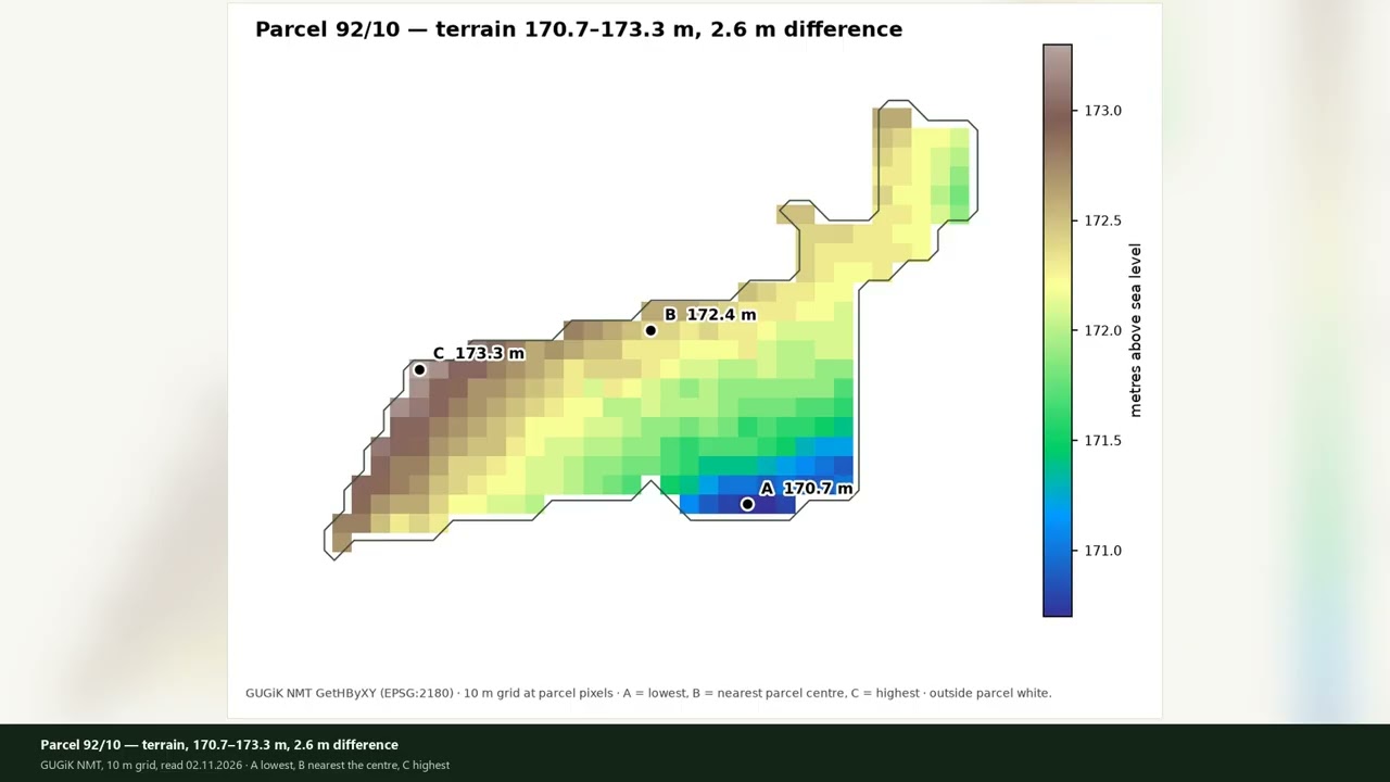
Field from Above turns a Polish parcel number into a dated, cloud-masked NDVI/NDRE map, an orthophoto with SAM 3.1 masks, and a short note that says what was measured, how uncertain it is, and where to walk first. I own five small fields, from 0.30 to 2.88 hectares. Satellite data covers them every few days, but a farmer cannot walk into a satellite image, and an agronomist is expensive for a 0.3-hectare strip. Every number carries its date, pixel count, cloud share and confidence interval. A separate fact check rejects any model text that adds a number or a date outside the measurement. When data is missing, the tool says so: parcel 90/1 returns a named absence, and a cloudy scene returns a cloud status instead of an old image shown as current. One date can lie, so the tool also reads the whole 2026 season and the national terrain model: a darker spot on parcel 92/10 looked like a problem on 26 October, but it came back in only 22 of 292 pixels (7.5%, threshold 10%), so the verdict is "does not return" and the note says not to start there. It is not a soil test and it does not recommend fertiliser. Live demo: https://kneblewskitomasz-sys.github.io/field-from-above/demo/