the-sp
Built at Meta Global AI Developer Hackathon · Oct 26, 2026 · Remote
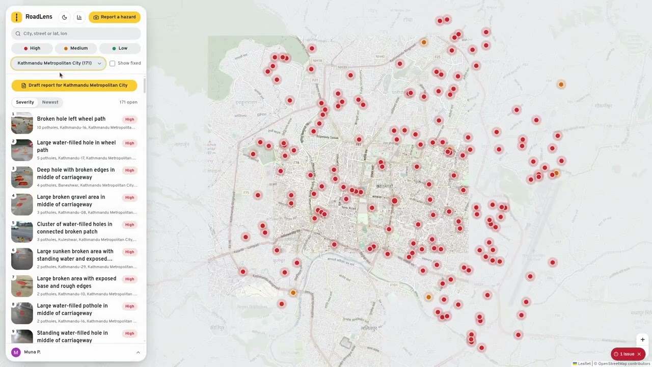
RoadLens turns one phone photo of a road hazard into a verified, mapped report the local authority can act on. A citizen snaps or uploads a photo, and can add a voice note. A Muse Spark agent then checks the photo while the user watches each step: SAM 3.1 outlines each hazard. The agent zooms in on anything unclear, and asks for a closer photo if it still can’t tell. It gives each hazard a High, Medium or Low priority with the reasons behind it: size, depth, position on the road and nearby context. The location comes from the photo’s GPS, falling back to the phone’s. A new photo of a hazard that’s already reported is merged into the existing one, so it adds to that report’s count instead of creating a duplicate pin. On the public map, hazards are colour-coded by priority and ranked by severity or by newest. Each one has a page you can share, and fixed hazards show before and after photos. Officers sign in with Google to a dashboard for their assigned areas. There they can mark hazards acknowledged or fixed, and get a drafted area report ready to email to the authority.