GeoWade AI
Built at Meta Global AI Developer Hackathon · Oct 26, 2026 · Remote
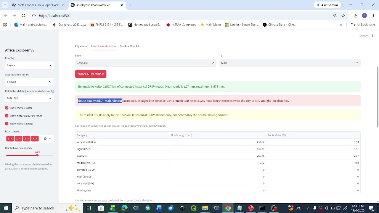
AfroHydro AI RoadWatch is an AI-powered geospatial decision-support application designed to help identify potential transport-access challenges across Africa. The application integrates daily AfroHydro rainfall estimates, historical GRIP4 road-network data, and Meta Muse Spark 1.3 to analyse rainfall exposure along road corridors and explain the results in accessible language. Users can explore rainfall across African countries, select cities, analyse connected historical road routes, and assess potential network detours using transparent GREEN, AMBER, and RED screening indicators. Meta Muse Spark interprets the numerical evidence, explains why corridors are flagged, highlights uncertainty, and recommends further investigation. The demonstration includes a Kenya corridor with a GREEN indicator and an Angola corridor with a RED indicator, illustrating how AI can help communicate complex geospatial results. RoadWatch addresses the need for accessible, evidence-based climate and transport infrastructure screening, particularly in regions where reliable road-condition information is limited. It is a preliminary planning tool, not a system for confirming flooding, road closures, or driving safety.